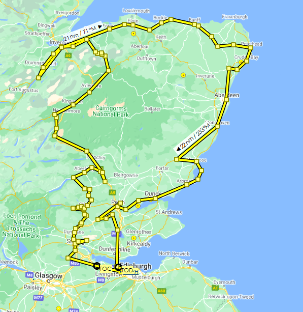
Following, as closely as possible, the route of Robert Burns’ Highland tour during the summer of 1787, completed nine years before his death at the age of 37. The flight plan is just under 500 nautical miles, so it can be done in one go, or split into sections as you see fit. I've included the flight plan in both MSFS (.pln) and Little Navmap (.lnmpln) formats.
Information taken from this Glasgow University project. Additional information here.
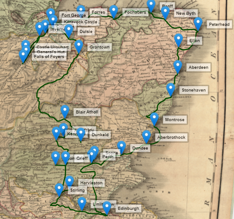
Burns began his month-long journey on 25 August, 1787, setting off from Edinburgh and travelling by horse and carriage in a clockwise direction. He stopped in Linlithgow, Stirling, Harviestoun, Comrie, Crieff, Kenmore, Aberfeldy, Dunkeld, Blair Atholl, Grantown-on-Spey, Dulsie, Fort George, Kilravock Castle, Culloden, Inverness, Castle Urquhart, General’s Hut, Fall of Foyers, Forres, Fochabers, Banff, New Byth, Peterhead, Ellon, Aberdeen, Stonehaven, Montrose, Aberbrothock, Dundee, Scone, Perth and Edinburgh.
There’s a long (36 nm) leg between the Falls of Foyers and Forres because he retraced his route back through Inverness after travelling south. (I did cut across Loch Ness to the Falls of Foyers after flying over Urquhart Castle, instead of going back north and then south down its eastern shore, to minimise further retracing.)
He takes a boat through Lunan Bay, and that is reflected in the flight plan.
Scenery suggestions for improved ground visuals from the air:
- Edinburgh scenery (almost 1 GB)
- Edinburgh Airport
- Dundee Airport
- Errol airfield

 newtestleper

