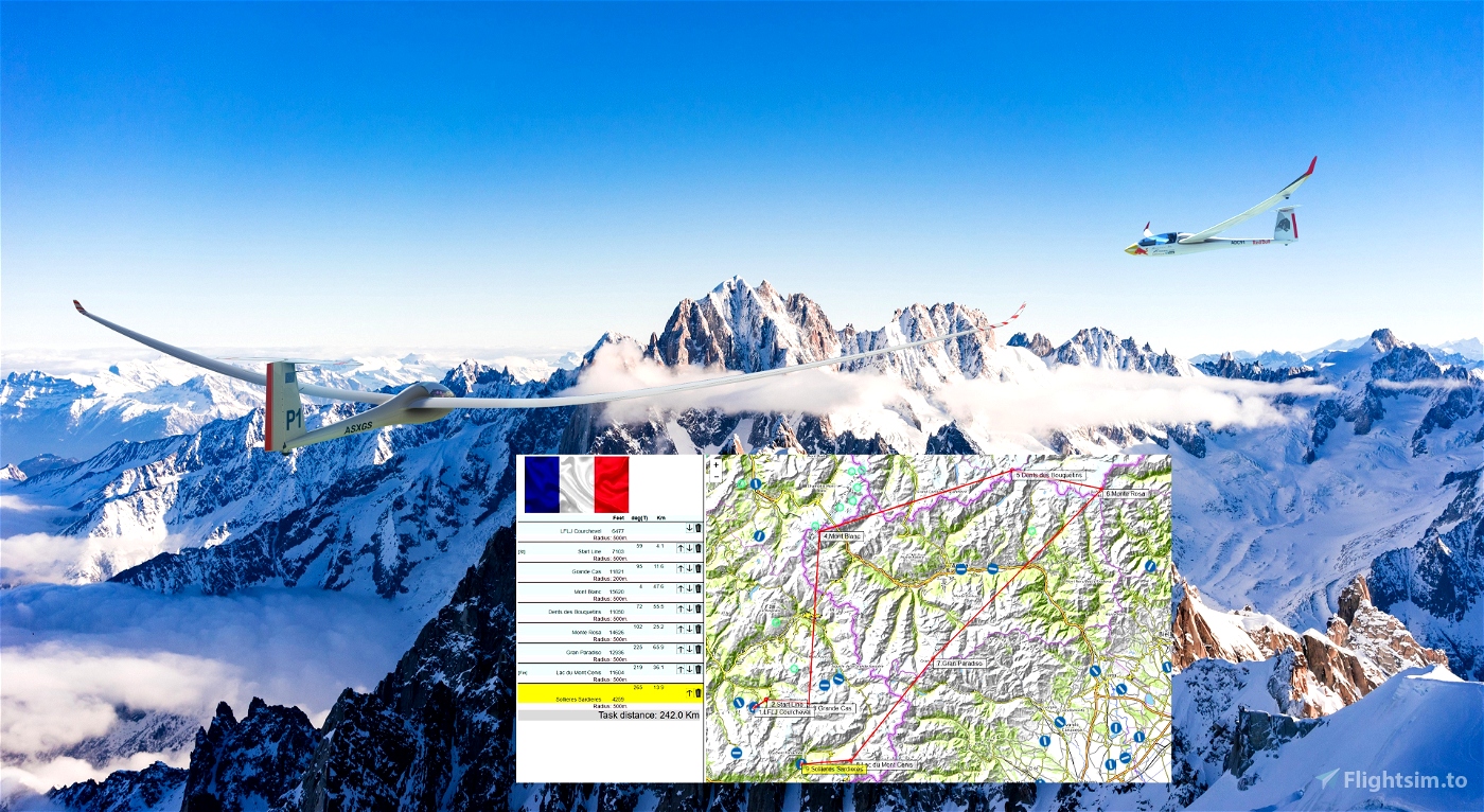
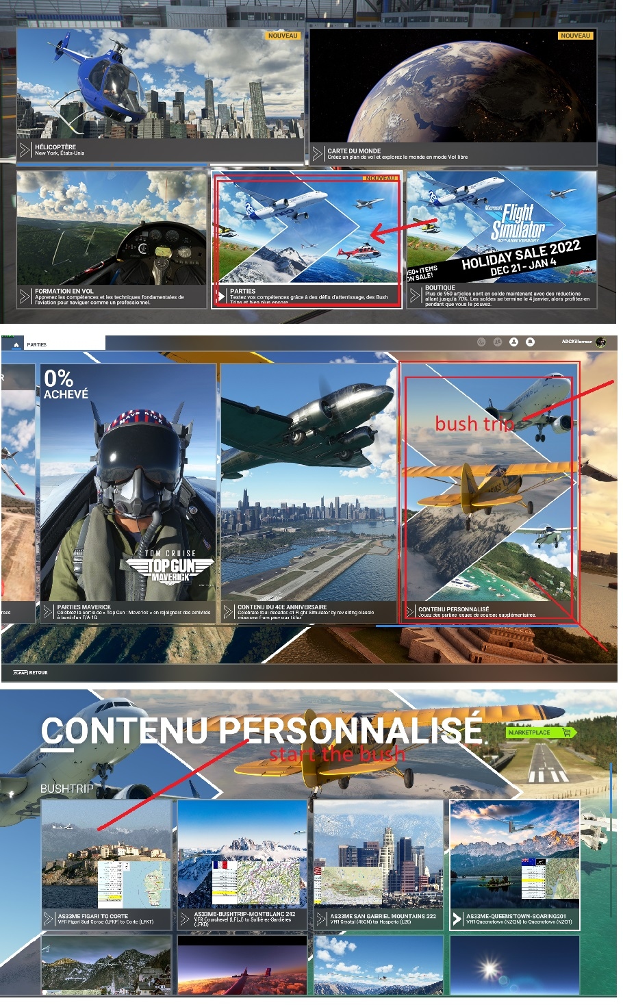
MONT BLANC FRENCH ALPES.Glider ride on French Alpes with AS33me.
.
You take off using your winch from LFLJ Courchevel airfield .
Departure: LFLJ
Destination: LFKD
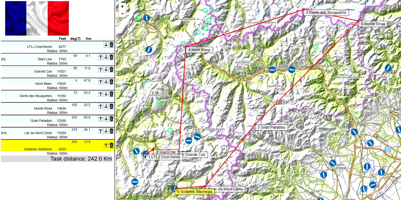
Distance: 242 km
Length: 1.5 - 2h
Difficulty: hard
Weather report:
Few clouds
15 kts wind from 310
Recommended Mods:
AS33 ME
https://fr.flightsim.to/file/15090/as-33-me
----
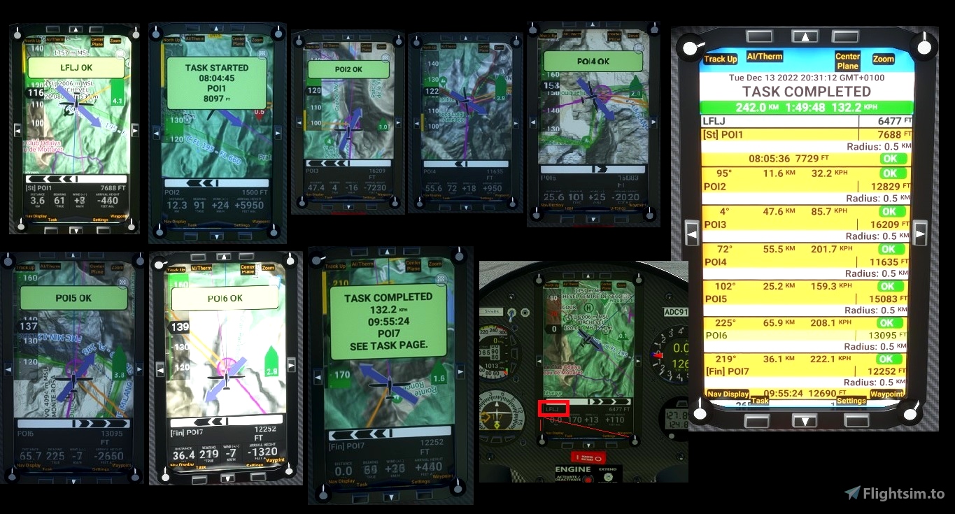
Use and look to GPS to validate all crossing points (notification when done).
Watch your GPS and wait for the map to finish loading.
Then adjust the GPS on the LFLJ tab .
Use your catapult to take off. Pull on the yellow handle.
Use your engine to take off.
Pass over the aerodrome to valid LFLJ
Make sure that you have validated the crossing point above the aerodrome.
Use and look to GPS to validate all crossing points (notification when done).
----
---------------
LFLJ Courchevel 6477
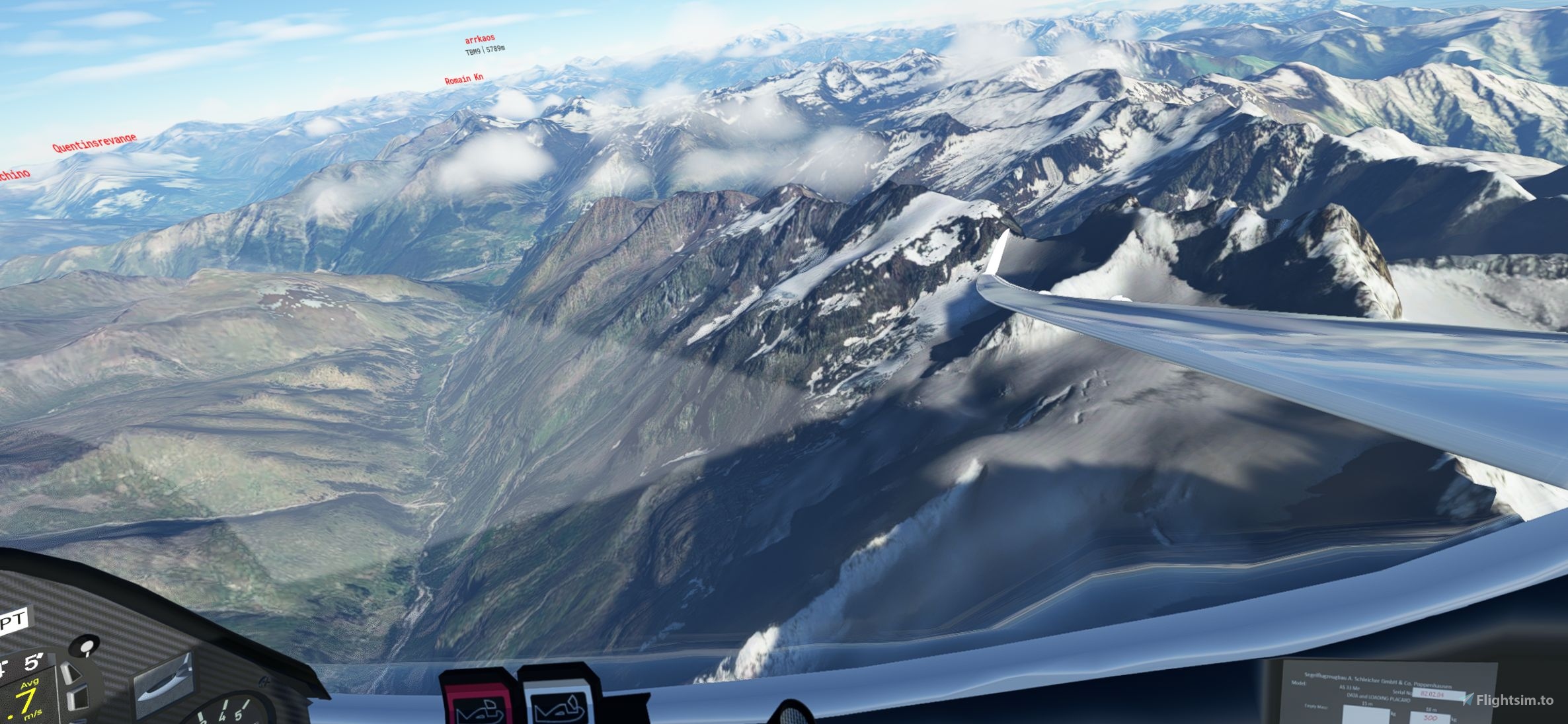
OK go to POI1: Starting line. Elevation 7103 feet
OK go to POI2: Grande Cas Elevation 11821 feet
OK go to POI3: Mont Blanc Elevation 15620 feet
OK go to POI4:Dents des Bouquetins Elevation 11052 feet
OK go to POI5: Monte Rosa. Elevation 14626 feet
OK go to POI6: Gran Paradiso. Elevation 12936 feet
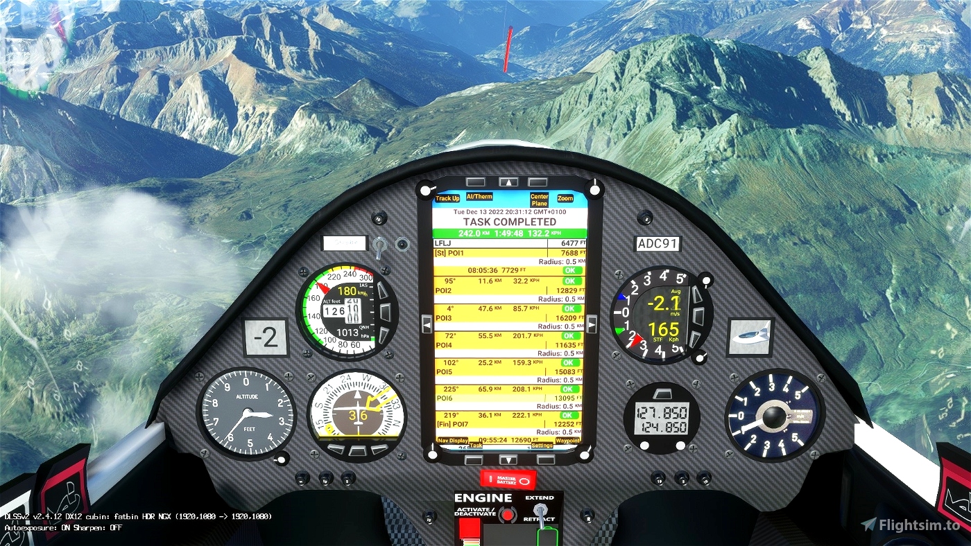
OK go to POI7: Lac du Mont Cenis. Elevation 11604feet
go Landing on Sollieres Sardieres Airport - LFKD 4259 feet
Turn off your main battery when you have landed

 ADCKillerman


Bonjour,
L'installation ne fonctionne pas. Quand j'arrive dans le menu "vos parties personnalisé", je n'ai rien. Pourtant d'autre bush trip d'autre auteur sont présents.
Pouvez vous m'aider ?
1 years ago
bonjour
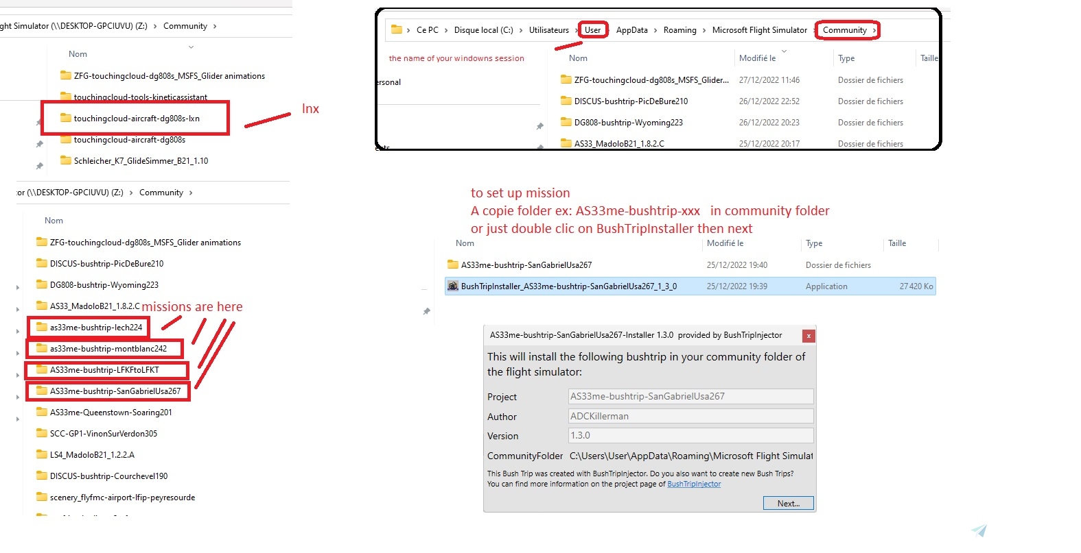
je viens de refaire l'installation et cela fonctionne pour moi.Je suis sur PC.
tu peux installer de façon manuelle en copiant le dossier as33me-bushtrip-montblanc242 dans community
1 years ago
ADCKillerman
Phoenix69
Thank you!
1 years ago
Ginete
Belle épreuve! bravo!
1 years ago
merci du retour
1 years ago
ADCKillerman
KIEBITZ405